Ambatomirahavavy | |
|---|---|
 Ambatomirahavavy Location in Madagascar | |
| Coordinates: 18°56′S 47°23′E / 18.933°S 47.383°E | |
| Country | |
| Region | Itasy |
| District | Arivonimamo |
| Government | |
| • Mayor | Jean Berthin Rabefeno |
| Elevation | 1,285 m (4,216 ft) |
| Population (2019)Census | |
| • Total | 19,163 |
| • Ethnicities | Merina |
| Time zone | UTC3 (EAT) |
| Postal code | 112 |
Ambatomirahavavy is municipality in Madagascar, 21 km west of the capital Antananrivo, on the National road No.1. It belongs to the district of Arivonimamo, which is a part of Itasy Region. The population of the commune was 19,163 in 2019.
Primary and junior level secondary education are available in town. The majority 97% of the population of the commune are farmers, while an additional 2% receives their livelihood from raising livestock. The most important crop is rice, while other important products are beans and cassava. Services provide employment for 1% of the population.[2]
Rivers
The municipality is crossed by two rivers: the Katsaoka (9 km) and the Andromba River (11 km), an affluent of the Ikopa River.
References
- ↑ Estimated based on DEM data from Shuttle Radar Topography Mission
- ↑ "ILO census data". Cornell University. 2002. Retrieved 2008-04-23.
Capital: Miarinarivo | ||
| Arivonimamo (22) - 112 | 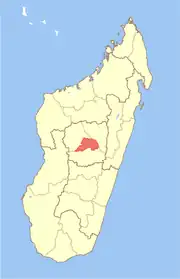 | |
| Miarinarivo (12) - 117 | ||
| Soavinandriana (15) - 118 | ||
3 districts; 49 communes | ||
18°56′S 47°23′E / 18.933°S 47.383°E