| Almost-a-Dog Mountain | |
|---|---|
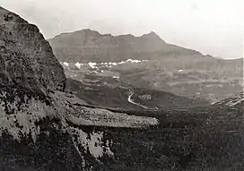 South aspect, 1914 | |
| Highest point | |
| Elevation | 8,922 ft (2,719 m)[1] |
| Prominence | 1,023 ft (312 m)[1] |
| Parent peak | Little Chief Mountain |
| Listing | Mountains in Glacier County, Montana |
| Coordinates | 48°37′22″N 113°37′08″W / 48.6227498°N 113.6189974°W[2] |
| Geography | |
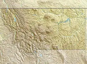 Almost-a-Dog Mountain Location in Montana  Almost-a-Dog Mountain Location in the United States | |
| Location | Glacier County, Montana, U.S. |
| Parent range | Lewis Range |
| Topo map | USGS Mount Stimson |
Almost-a-Dog Mountain (8,922 ft (2,719 m)) is located in the Lewis Range, Glacier National Park in the U.S. state of Montana.[3] The mountain is named for a Blackfoot warrior Almost A Dog or Imazí-imita who was a survivor of the 1870 Marias Massacre. Although his entire family perished in the attack, he survived but was crippled for life. He also survived the so-called Winter of Starvation in 1883–84.[4]
See also
References
- 1 2 "Almost-a-Dog Mountain, Montana". Peakbagger.com. Retrieved May 30, 2018.
- ↑ "Almost-a-Dog Mountain". Geographic Names Information System. United States Geological Survey, United States Department of the Interior. Retrieved May 30, 2018.
- ↑ Mount Stimson, MT (Map). TopoQwest (United States Geological Survey Maps). Retrieved May 30, 2018.
- ↑ Holterman, Jack (2006). Place Names of Glacier National Park. Helena, MT: Riverbend Publishing. p. 20. ISBN 1-931832-68-4.
External links
- "Picture of Almost-a-Dog Mountain". SummitPost.org. Retrieved 2011-05-07.
- Almost-a-Dog Mountain photo: Flickr
This article is issued from Wikipedia. The text is licensed under Creative Commons - Attribution - Sharealike. Additional terms may apply for the media files.