| Afton Run Tributary to Coddle Creek | |
|---|---|
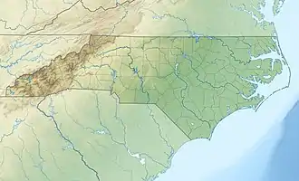 Location of Afton Run mouth  Afton Run (the United States) | |
| Location | |
| Country | United States |
| State | North Carolina |
| County | Cabarrus |
| Physical characteristics | |
| Source | Mill Creek divide |
| • location | about 2 miles west of Kannapolis, North Carolina |
| • coordinates | 35°29′20″N 080°40′39″W / 35.48889°N 80.67750°W[1] |
| • elevation | 790 ft (240 m)[2] |
| Mouth | Coddle Creek |
• location | about 3 miles west of Concord, North Carolina |
• coordinates | 35°24′31″N 080°40′29″W / 35.40861°N 80.67472°W[1] |
• elevation | 589 ft (180 m)[2] |
| Length | 6.13 mi (9.87 km)[3] |
| Basin size | 6.07 square miles (15.7 km2)[4] |
| Discharge | |
| • location | Coddle Creek |
| • average | 7.25 cu ft/s (0.205 m3/s) at mouth with Coddle Creek[4] |
| Basin features | |
| Progression | Coddle Creek → Rocky River → Pee Dee River → Winyah Bay → Atlantic Ocean |
| River system | Pee Dee River |
| Tributaries | |
| • left | unnamed tributaries |
| • right | unnamed tributaries |
| Bridges | Mooresville Road, Dogwood Boulevard, Trinity Church Road, Kannapolis Parkway, NC 73, I-85 |
Afton Run is a 6.13 mi (9.87 km) long 1st order tributary to Coddle Creek in Cabarrus County, North Carolina. This is the only stream of this name in the United States.[1]
Variant names
According to the Geographic Names Information System, it has also been known historically as:[1]
- Ashton Branch
- Astin's Branch
Course
Afton Run rises about 2 miles west of Kannapolis, North Carolina and then flows south to join Coddle Creek about 3 miles west of Concord.[2]
Watershed
Afton Run drains 6.07 square miles (15.7 km2) of area, receives about 46.9 in/year of precipitation, has a wetness index of 411.40, and is about 32% forested.[4]
References
- 1 2 3 4 "GNIS Detail – Afton Run". geonames.usgs.gov. US Geological Survey. Retrieved 12 November 2020.
- 1 2 3 "Get Maps". USGS Topoview. US Geological Survey. Retrieved 12 November 2020.
- ↑ "ArcGIS Web Application". epa.maps.arcgis.com. US EPA. Retrieved 12 November 2020.
- 1 2 3 "Afton Run Watershed Report". US EPA Geoviewer. US EPA. Retrieved 12 November 2020.
This article is issued from Wikipedia. The text is licensed under Creative Commons - Attribution - Sharealike. Additional terms may apply for the media files.