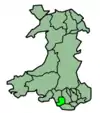
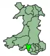
 | |
|---|---|
| Major junctions | |
| South end | Bridgend |
| North end | Cymer |
| Location | |
| Country | United Kingdom |
| Constituent country | Wales |
| Primary destinations | Bridgend |
| Road network | |
Settlements on route
Settlements served by the route include:
- Bridgend
- Wild Mill
- Pen-y-fai
- Sarn
- Aberkenfig
- Tondu
- Coytrahen
- Llangynwyd
- Cwmfelin
- Maesteg
- Nantyffyllon
- Dyffryn
- Caerau
- Croeserw
- Cymer
Geohash Coordinates:[1] gcjmmqdnqp2
References
- ↑ Latitude.to. "GPS coordinates of A4063 road, United Kingdom. Latitude: 51.5847 Longitude: -3.6335". Latitude.to, maps, geolocated articles, latitude longitude coordinate conversion. Retrieved 5 December 2018.
Sources
This article is issued from Wikipedia. The text is licensed under Creative Commons - Attribution - Sharealike. Additional terms may apply for the media files.

