What is the explanation for the apparent size difference of North America in these two photos from NASA?
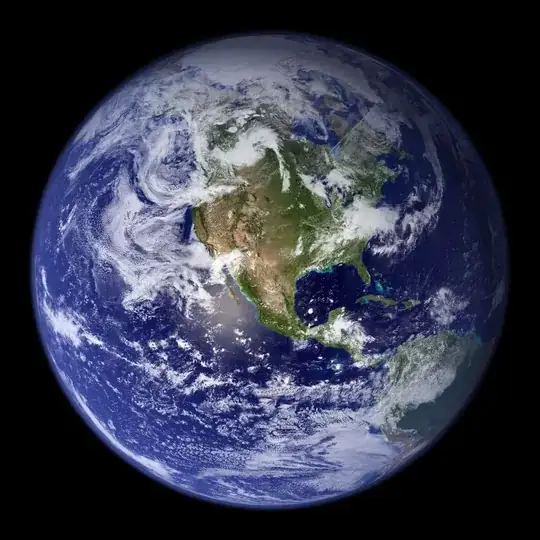
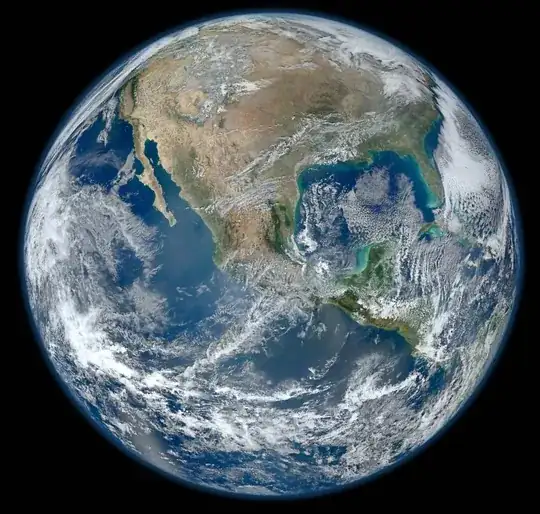
What is the explanation for the apparent size difference of North America in these two photos from NASA?
This is a perspective effect. In essence, the second image is taken from a lower orbit which is closer to Earth, and the Earth only looks spherical because of the use of a fisheye lens that strongly distorts the edges of the image.
This means that the field of view is a lot smaller. The Earth still looks like a circle on the page, though from close up the edges can look a bit distorted. In the second image there is no land to be distorted in the edges, and there are effects from the camera lens which can look weird to the human eye (to make the apparent sizes match you're comparing a very wide angle lens with a much narrower one). However, this effect is not photoshop magic.
(That said, the first image is, in fact, a very carefully reconstructed mosaic that is made from images taken at much lower altitudes, in a painstaking process that is explained in detail in this Earth Observatory post. It's important to emphasize that, from whatever altitude Simmon simulated, this is indeed the continental layout that you would observe with your naked eye. The original posting of this image clearly identifies it as a mosaic: NASA is always very careful to precisely label every image it publishes in a correct fashion.)
I can't find, unfortunately, the altitude that Simmons used to simulate the first image. Any brave takers care to dig through the documentation and source files to see if it's there?
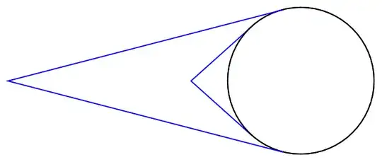
The second image, referenced here, was taken by Suomi NPP from an altitude of ~830 km, from where the perspective looks roughly like this,

where it is obvious that the wide field of view is only possible because of the fisheye lens, with its associated distorsions.
The most eminent feature of the "Blue Marble" photo, the image uniformity, is not discussed in the literature, not even mentioned. The earth's image includes large areas of gas-phase – clouds, liquid-phase – oceans, and solid-phase – land, and the uniformity is nearly true for each phase separately. This feature is not compatible with Lambert's cosine law. One photo – a thousand theories.