I've heard that some townships in Ontario are subdivided and others are not.
Correspondence with the Ontario Ministry of Energy and Mines:
These [mining] claims are located in the subdivided township of […], when a claim within a subdivided township is being brought to lease the survey instructions are a little different. For example, when a claim is located in an unsubdivided township the Office of the Surveyor General (OSG) issues perimeter survey instructions, and when the claims are located in a subdivided township the Ministry of Energy and Mines (MEM) would prepare the instructions to survey the mining claims, have the OSG review them but it’s MEM’s responsibility to issue to the surveyor or choice.
List of Subdivided Townships in the Province of Ontario with Dates and Systems of Survey (PDF)
What does it mean when a township is subdivided?
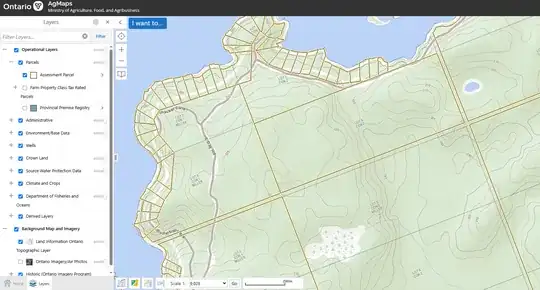
For reference, here is a screenshot from an Ontario government map that shows the lots/cons in the topo base layer, as well as a parcel layer in yellow.
- Ontario OMAFRA AgMaps web map
- Lat: 44.98448° N, Lon: 77.05794° W
- Current municipalities: North Frontenac (lower tier), County of Frontenac (upper tier)
- Former/historic/geographic township: Miller
