Wutha-Farnroda | |
|---|---|
 Coat of arms | |
Location of Wutha-Farnroda within Wartburgkreis district 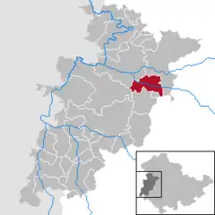 | |
 Wutha-Farnroda 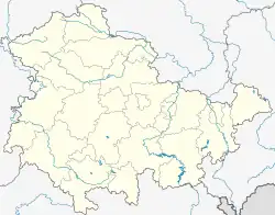 Wutha-Farnroda | |
| Coordinates: 50°56′48″N 10°23′41″E / 50.94667°N 10.39472°E | |
| Country | Germany |
| State | Thuringia |
| District | Wartburgkreis |
| Government | |
| • Mayor (2020–26) | Jörg Schlothauer[1] |
| Area | |
| • Total | 36.55 km2 (14.11 sq mi) |
| Highest elevation | 470 m (1,540 ft) |
| Lowest elevation | 232 m (761 ft) |
| Population (2022-12-31)[2] | |
| • Total | 6,436 |
| • Density | 180/km2 (460/sq mi) |
| Time zone | UTC+01:00 (CET) |
| • Summer (DST) | UTC+02:00 (CEST) |
| Postal codes | 99848 |
| Dialling codes | 036921 |
| Vehicle registration | WAK |
| Website | www.wutha-farnroda.de |
Wutha-Farnroda is a municipality in the Wartburgkreis district of Thuringia, Germany.
Wutha station is located on the Halle–Bebra railway.
Population development
- 1994: 8.770
- 2000: 7.794
- 2004: 7.405
- 2010: 6.560
- 2014: 6.360

Half-timbered houses
References
- ↑ Gewählte Bürgermeister - aktuelle Landesübersicht, Freistaat Thüringen, accessed 14 July 2021.
- ↑ "Bevölkerung der Gemeinden, erfüllenden Gemeinden und Verwaltungsgemeinschaften in Thüringen Gebietsstand: 31.12.2022" (in German). Thüringer Landesamt für Statistik. June 2023.
External links
 Media related to Wutha-Farnroda at Wikimedia Commons

This article is issued from Wikipedia. The text is licensed under Creative Commons - Attribution - Sharealike. Additional terms may apply for the media files.