Rolo | |
|---|---|
| Comune di Rolo | |
 | |
Location of Rolo | |
 Rolo Location of Rolo in Italy 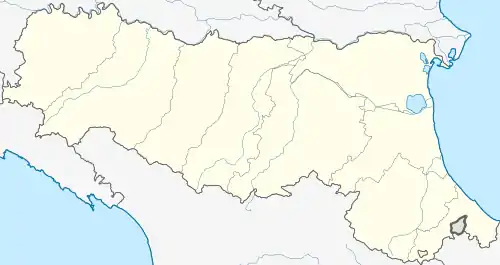 Rolo Rolo (Emilia-Romagna) | |
| Coordinates: 44°53′N 10°51′E / 44.883°N 10.850°E | |
| Country | Italy |
| Region | Emilia-Romagna |
| Province | Reggio Emilia (RE) |
| Frazioni | Ronchi |
| Government | |
| • Mayor | Luca Nasi |
| Area | |
| • Total | 14.17 km2 (5.47 sq mi) |
| Elevation | 21 m (69 ft) |
| Population (31 December 2017)[2] | |
| • Total | 4,062 |
| • Density | 290/km2 (740/sq mi) |
| Demonym | Rolesi |
| Time zone | UTC+1 (CET) |
| • Summer (DST) | UTC+2 (CEST) |
| Postal code | 42047 |
| Dialing code | 0522 |
| Patron saint | St. Zeno |
| Saint day | April 12 |
| Website | Official website |
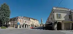
Rolo (Reggiano: Rôl or Rōl) is a comune (municipality) in the Province of Reggio Emilia in the Italian region Emilia-Romagna, located about 60 kilometres (37 mi) northwest of Bologna and about 25 kilometres (16 mi) northeast of Reggio Emilia.
Rolo borders the following municipalities: Carpi, Fabbrico, Moglia, Novi di Modena, Reggiolo.
References
- ↑ "Superficie di Comuni Province e Regioni italiane al 9 ottobre 2011". Italian National Institute of Statistics. Retrieved 16 March 2019.
- ↑ All demographics and other statistics: Italian statistical institute Istat.
External links
This article is issued from Wikipedia. The text is licensed under Creative Commons - Attribution - Sharealike. Additional terms may apply for the media files.