Ranadi | |
|---|---|
Suburb | |
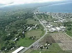 Ranadi looking east | |
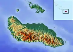 Ranadi Location in Guadalcanal | |
| Coordinates: 9°26′S 159°57′E / 9.433°S 159.950°E | |
| Country | |
| Province | Honiara Town |
| Island | Guadalcanal |
| Elevation | 29 m (95 ft) |
| Time zone | UTC+11 (UTC) |
Ranadi is a suburb of Honiara, Solomon Islands and is located West of Panatina.
References
8°46′S 160°42′E / 8.767°S 160.700°E
This article is issued from Wikipedia. The text is licensed under Creative Commons - Attribution - Sharealike. Additional terms may apply for the media files.