Poggio-d'Oletta | |
|---|---|
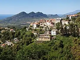 The church of San Cervone and the surrounding buildings, in Poggio-d'Oletta | |
Location of Poggio-d'Oletta | |
 Poggio-d'Oletta 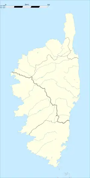 Poggio-d'Oletta | |
| Coordinates: 42°38′25″N 9°21′47″E / 42.6403°N 9.3631°E | |
| Country | France |
| Region | Corsica |
| Department | Haute-Corse |
| Arrondissement | Calvi |
| Canton | Biguglia-Nebbio |
| Government | |
| • Mayor (2020–2026) | Antoine Vincenti[1] |
| Area 1 | 16.16 km2 (6.24 sq mi) |
| Population | 215 |
| • Density | 13/km2 (34/sq mi) |
| Time zone | UTC+01:00 (CET) |
| • Summer (DST) | UTC+02:00 (CEST) |
| INSEE/Postal code | 2B239 /20232 |
| Elevation | 0–852 m (0–2,795 ft) (avg. 350 m or 1,150 ft) |
| 1 French Land Register data, which excludes lakes, ponds, glaciers > 1 km2 (0.386 sq mi or 247 acres) and river estuaries. | |
Poggio-d'Oletta is a commune in the Haute-Corse department of France on the island of Corsica.
Population
| Year | Pop. | ±% |
|---|---|---|
| 1962 | 151 | — |
| 1968 | 155 | +2.6% |
| 1975 | 142 | −8.4% |
| 1982 | 125 | −12.0% |
| 1990 | 109 | −12.8% |
| 1999 | 140 | +28.4% |
| 2008 | 215 | +53.6% |
See also
References
- ↑ "Répertoire national des élus: les maires". data.gouv.fr, Plateforme ouverte des données publiques françaises (in French). 2 December 2020.
- ↑ "Populations légales 2021". The National Institute of Statistics and Economic Studies. 28 December 2023.
Wikimedia Commons has media related to Poggio-d'Oletta.
This article is issued from Wikipedia. The text is licensed under Creative Commons - Attribution - Sharealike. Additional terms may apply for the media files.