| Mount Denjō | |
|---|---|
| 殿城山 | |
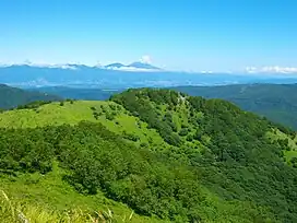 Seen from the southwest. Mount Asama in the background. | |
| Highest point | |
| Elevation | 1,800 m (5,900 ft) |
| Listing | List of mountains and hills of Japan by height |
| Coordinates | 36°6′52″N 138°12′19″E / 36.11444°N 138.20528°E |
| Naming | |
| Language of name | Japanese |
| Pronunciation | [dendʑoːsaɴ] |
| Geography | |
| Location | Nagawa, Nagano, Japan |
| Parent range | Kirigamine |
Mount Denjō (殿城山, Denjō-san) is a 1,800 m (5,906 ft) mountain of Chushin Highland, located in Nagawa, Nagano. This mountain is a part of the Yatsugatake-Chūshin Kōgen Quasi-National Park.
Leisure
On Mount Denjō, there is Echo Valley Ski Resort.
Route
There are several routes to the top of the mountain. The easiest route is to climb from Himekidaira. Other routes are from Mount Kuruma or Mount Ōsasa.
Access
- Himekidaira-Chuo Bus Stop of JR Kanto Bus
Gallery
 Mount Denjō from near the top
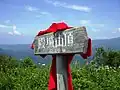 At the top of Mount Denjō
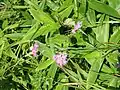 Kawara-Nadeshiko at the top of Mount Denjō
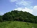
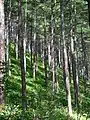 A Forest of Mount Denjō
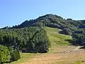 Mount Denjō from Echo Valley Ski Resort
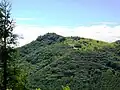 Mount Denjō from Mount Ōsasa
References
- Official Home Page of the Geographical Survey Institute in Japan
- ‘Yatsugatake, Tateshina, Utsukushigahara, Kirigamine 2008, Shobunsha
Wikimedia Commons has media related to Mount Denjō.
This article is issued from Wikipedia. The text is licensed under Creative Commons - Attribution - Sharealike. Additional terms may apply for the media files.