Kobern-Gondorf | |
|---|---|
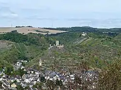 Kobern with its lower and upper castles | |
 Coat of arms | |
Location of Kobern-Gondorf within Mayen-Koblenz district  | |
 Kobern-Gondorf 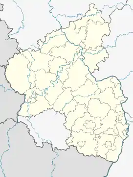 Kobern-Gondorf | |
| Coordinates: 50°18′17″N 7°27′26″E / 50.30472°N 7.45722°E | |
| Country | Germany |
| State | Rhineland-Palatinate |
| District | Mayen-Koblenz |
| Municipal assoc. | Rhein-Mosel |
| Subdivisions | 3 |
| Government | |
| • Mayor (2019–24) | Michael Dötsch[1] |
| Area | |
| • Total | 28.36 km2 (10.95 sq mi) |
| Highest elevation | 300 m (1,000 ft) |
| Lowest elevation | 70 m (230 ft) |
| Population (2021-12-31)[2] | |
| • Total | 3,117 |
| • Density | 110/km2 (280/sq mi) |
| Time zone | UTC+01:00 (CET) |
| • Summer (DST) | UTC+02:00 (CEST) |
| Postal codes | 56330 |
| Dialling codes | 02607 |
| Vehicle registration | MYK |
| Website | www.kobern-gondorf.de |
Kobern-Gondorf is a municipality in the district of Mayen-Koblenz in Rhineland-Palatinate, western Germany. It is the seat of the Verbandsgemeinde Rhein-Mosel.
Above the village are the two castles of Niederburg and Oberburg.
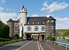
Gondorf Castle: street breach of the federal highway Bundesstraße 416
References
- ↑ Direktwahlen 2019, Landkreis Mayen-Koblenz, Landeswahlleiter Rheinland-Pfalz, accessed 5 August 2021.
- ↑ "Bevölkerungsstand 2021, Kreise, Gemeinden, Verbandsgemeinden" (in German). Statistisches Landesamt Rheinland-Pfalz. 2022.
Wikimedia Commons has media related to Kobern-Gondorf.
This article is issued from Wikipedia. The text is licensed under Creative Commons - Attribution - Sharealike. Additional terms may apply for the media files.