| Khachinchay | |
|---|---|
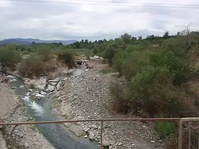 Khachinchay flowing through Nagorno-Karabakh | |
| Native name | Xaçınçay (Azerbaijani) |
| Location | |
| Country | Azerbaijan |
| Region | Caucasus |
| District | Kalbajar, Aghdam, Tartar and Barda District |
| Physical characteristics | |
| Source | Karabakh Plateau |
| • location | Azerbaijan |
| • coordinates | 39°59′43″N 46°19′39″E / 39.99528°N 46.32750°E |
| Mouth | Kura |
• location | Azerbaijan |
• coordinates | 40°15′23″N 47°27′52″E / 40.25639°N 47.46444°E |
| Length | 119 km (74 mi) |
| Basin features | |
| Progression | Kura→ Caspian Sea |
Khachinchay[lower-alpha 1] is a river in Azerbaijan that passes through the region of Nagorno-Karabakh.[1] It begins in the Karabakh Plateau, in the Kalbajar District and continues through the Aghdam, Tartar and Barda District.[2][3] It enters the Kura on the right.[3]
Khachinchay is 119 km (74 mi) long. The height difference between the source and the mouth is 2,900 m (9,500 ft).[2]
See also
Notes
- ↑ Armenian: Խաչեն, Khachen; Azerbaijani: Xaçınçay
References
- ↑ Komisja Standaryzacji Nazw Geograficznych poza granicami Polski (2005). "Azja Środkowa i Zakaukazie" (PDF). Warsaw: Główny Urząd Geodezji i Kartografii. p. 50. ISBN 83-239-9019-0. Retrieved 2017-04-30.
- 1 2 "Rivers. Garabagh Region". Garabagh.net. Archived from the original on 2014-08-10. Retrieved 2017-04-30.
- 1 2 "Rivers, lakes and reservoir of Azerbeijan Republic". Ministry of Ecology and Natural Resources. Retrieved 2017-04-30.
This article is issued from Wikipedia. The text is licensed under Creative Commons - Attribution - Sharealike. Additional terms may apply for the media files.