| Kem | |
|---|---|
 | |
| Location | |
| Country | Russia |
| Physical characteristics | |
| Source | |
| • location | Lake Lower Kuyto |
| • elevation | 100 m (330 ft) |
| Mouth | White Sea |
• coordinates | 64°57′03″N 34°40′29″E / 64.9508°N 34.6746°E |
| Length | 191 km (119 mi) |
| Basin size | 27,700 km2 (10,700 sq mi) |
| Discharge | |
| • average | 275 m3/s (9,700 cu ft/s) |
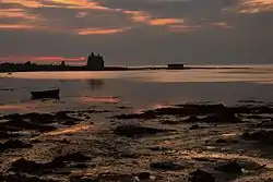
The Kem (Russian: Кемь, Finnish: Kemijoki) is a river in Republic of Karelia, Russia. It starts from Lake Lower Kuyto and flows through a number of lakes into the White Sea. It is 191 kilometres (119 mi) long, and has a drainage basin of 27,700 square kilometres (10,700 sq mi).[1] There is a cascade of 5 hydroelectric power plants. The town of Kem is located in the mouth of the Kem. Tributaries: Chirka-Kem, Okhta, Kepa, Shomba.[2]
See also
References
- ↑ "Река КЕМЬ in the State Water Register of Russia". textual.ru (in Russian).
- ↑ Кемь (река в Карельской АССР), Great Soviet Encyclopedia
This article is issued from Wikipedia. The text is licensed under Creative Commons - Attribution - Sharealike. Additional terms may apply for the media files.