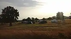
Kadugli
كادوقلي Kaduqli | |
|---|---|
 | |
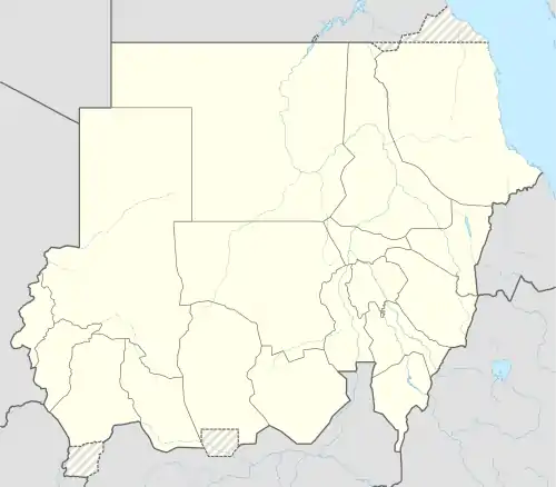 Kadugli Location in Sudan | |
| Coordinates: 11°1′0″N 29°43′0″E / 11.01667°N 29.71667°E | |
| Country | |
| State | South Kordofan |
| Population (2005) | |
| • Total | 92,674 (est) |
Kaduqli or Kadugli[1] (Arabic: كادوقلي Kādūqlī Sudanese pronunciation: [kaːˈduɢli]) is the capital city of South Kordofan State, Sudan. It is located 240 kilometres (150 mi) south of El-Obeid, at the northern edge of the White Nile plain in the Nuba Mountains. It contains Hilal Stadium.
History
The Battle of Kadugli broke out during the 2023 Sudan conflict.[2]
Economy
It is a trading centre for gum arabic and livestock. Industries include textiles, soap factories, and the production of leather.[3]
During the UNMIS (United Nations Mission in Sudan), Kaduqli was the Sector IV Headquarters. It housed the Egyptian Contingent and based the Indian Aviation Contingent's MI-17 helicopters.
Climate
Kaduqli has a hot semi-arid climate (Köppen climate classification BSh).
| Climate data for Kaduqli (1961–1990) | |||||||||||||
|---|---|---|---|---|---|---|---|---|---|---|---|---|---|
| Month | Jan | Feb | Mar | Apr | May | Jun | Jul | Aug | Sep | Oct | Nov | Dec | Year |
| Record high °C (°F) | 41.8 (107.2) |
42.1 (107.8) |
44.2 (111.6) |
44.0 (111.2) |
44.2 (111.6) |
41.6 (106.9) |
40.7 (105.3) |
37.5 (99.5) |
39.2 (102.6) |
40.0 (104.0) |
41.2 (106.2) |
40.3 (104.5) |
44.2 (111.6) |
| Mean daily maximum °C (°F) | 34.4 (93.9) |
36.1 (97.0) |
38.9 (102.0) |
40.0 (104.0) |
38.3 (100.9) |
35.1 (95.2) |
32.1 (89.8) |
31.4 (88.5) |
32.8 (91.0) |
35.2 (95.4) |
36.4 (97.5) |
34.9 (94.8) |
35.5 (95.9) |
| Daily mean °C (°F) | 25.9 (78.6) |
27.7 (81.9) |
30.5 (86.9) |
31.7 (89.1) |
31.7 (89.1) |
28.8 (83.8) |
26.9 (80.4) |
26.3 (79.3) |
26.7 (80.1) |
27.7 (81.9) |
27.5 (81.5) |
26.4 (79.5) |
28.2 (82.8) |
| Mean daily minimum °C (°F) | 17.4 (63.3) |
19.3 (66.7) |
22.0 (71.6) |
23.5 (74.3) |
23.8 (74.8) |
22.5 (72.5) |
21.7 (71.1) |
21.2 (70.2) |
20.7 (69.3) |
20.2 (68.4) |
18.7 (65.7) |
17.9 (64.2) |
20.7 (69.3) |
| Record low °C (°F) | 10.2 (50.4) |
11.1 (52.0) |
15.3 (59.5) |
14.8 (58.6) |
15.9 (60.6) |
16.8 (62.2) |
15.3 (59.5) |
17.4 (63.3) |
16.3 (61.3) |
9.7 (49.5) |
11.6 (52.9) |
10.0 (50.0) |
9.7 (49.5) |
| Average precipitation mm (inches) | 0.0 (0.0) |
0.0 (0.0) |
3.3 (0.13) |
10.9 (0.43) |
60.6 (2.39) |
99.7 (3.93) |
134.9 (5.31) |
163.1 (6.42) |
98.7 (3.89) |
61.0 (2.40) |
0.9 (0.04) |
0.0 (0.0) |
633.1 (24.93) |
| Average precipitation days (≥ 0.1 mm) | 0.0 | 0.0 | 0.5 | 1.3 | 6.1 | 9.2 | 12.9 | 14.7 | 10.8 | 6.5 | 0.3 | 0.0 | 62.3 |
| Average relative humidity (%) | 21 | 18 | 18 | 25 | 45 | 61 | 75 | 79 | 78 | 63 | 33 | 27 | 45.2 |
| Mean monthly sunshine hours | 306.9 | 277.2 | 275.9 | 279.0 | 266.6 | 228.0 | 182.9 | 182.9 | 195.0 | 251.1 | 303.0 | 313.1 | 3,061.6 |
| Percent possible sunshine | 86 | 84 | 73 | 75 | 67 | 55 | 46 | 47 | 53 | 68 | 87 | 87 | 69 |
| Source: NOAA[4] | |||||||||||||
External links
References
- ↑ The most frequently encountered spelling is Kadugli, used in The Times Atlas of the World and other sources.
- ↑ "Sudan's western cities under fire as war spreads". Reuters. 2023-06-14. Retrieved 2023-06-19.
- ↑ "Kāduqlī | Sudan | Britannica". www.britannica.com. Retrieved 2022-01-11.
- ↑ "Kadugli (Kaduqli) Climate Normals 1961–1990". National Oceanic and Atmospheric Administration. Retrieved January 18, 2016.
This article is issued from Wikipedia. The text is licensed under Creative Commons - Attribution - Sharealike. Additional terms may apply for the media files.