| Harahorn | |
|---|---|
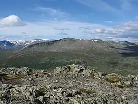 Harahorn seen form the mountain Kvitingane (south) in the summer. | |
| Highest point | |
| Elevation | 1,581 m (5,187 ft) |
| Coordinates | 60°56′27″N 8°29′37″E / 60.94083°N 8.49361°E |
| Geography | |
| Location | Hemsedal (Buskerud) |
| Topo map | 1616 IV Hemsedal |
Harahorn, also written Harahødn, is a mountain located in the Hemsedal municipality in Norway. It is a part of Hemsedal Top 20.
This article is issued from Wikipedia. The text is licensed under Creative Commons - Attribution - Sharealike. Additional terms may apply for the media files.