Follo | |
|---|---|
| Comune di Follo | |
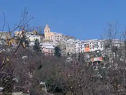 Follo Castello. | |
 Coat of arms | |
Location of Follo | |
 Follo Location of Follo in Italy 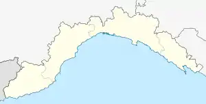 Follo Follo (Liguria) | |
| Coordinates: 44°10′N 9°51′E / 44.167°N 9.850°E | |
| Country | Italy |
| Region | Liguria |
| Province | La Spezia (SP) |
| Frazioni | Bastremoli, Carnea, Follo Alto, Piana Battolla, Piano di Follo, Sorbolo, Tivegna, Torenco, Val Durasca, Via Romana |
| Government | |
| • Mayor | Giorgio Cozzani |
| Area | |
| • Total | 23.1 km2 (8.9 sq mi) |
| Elevation | 70 m (230 ft) |
| Population | |
| • Total | 6,239 |
| • Density | 270/km2 (700/sq mi) |
| Demonym | Follesi |
| Time zone | UTC+1 (CET) |
| • Summer (DST) | UTC+2 (CEST) |
| Postal code | 19020 |
| Dialing code | 0187 |
| Patron saint | St. Martin of Tours |
| Saint day | 11 November |
| Website | Official website |
Follo (locally U Fulu) is a comune (municipality) in the Province of La Spezia in the Italian region Liguria, located about 80 kilometres (50 mi) southeast of Genoa and about 8 kilometres (5 mi) northeast of La Spezia, between the Val di Vara, the Gulf of La Spezia and the Val di Magra plain.
Follo borders the following municipalities: Beverino, Bolano, Calice al Cornoviglio, La Spezia, Podenzana, Riccò del Golfo di Spezia, Vezzano Ligure.
References
- ↑ "Superficie di Comuni Province e Regioni italiane al 9 ottobre 2011". Italian National Institute of Statistics. Retrieved 16 March 2019.
- ↑ All demographics and other statistics: Italian statistical institute Istat.
- ↑ "Popolazione Residente al 1° Gennaio 2018". Italian National Institute of Statistics. Retrieved 16 March 2019.
External links
This article is issued from Wikipedia. The text is licensed under Creative Commons - Attribution - Sharealike. Additional terms may apply for the media files.