| Druesberg | |
|---|---|
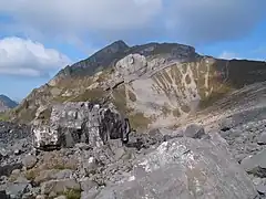
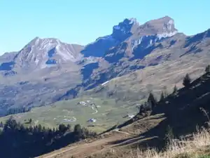 Druesberg with Twäriberg and Forstberg | |
| Highest point | |
| Elevation | 2,282 m (7,487 ft) |
| Prominence | 722 m (2,369 ft)[1] |
| Parent peak | Mutteristock |
| Coordinates | 47°0′15″N 8°50′0″E / 47.00417°N 8.83333°E |
| Geography | |
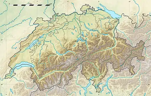 Druesberg Location in Switzerland | |
| Location | Schwyz, Switzerland |
| Parent range | Schwyzer Alps |
| Climbing | |
| Easiest route | Hike |
The Druesberg (or Drusberg) is a mountain located north of Pragel Pass in the Schwyzer Alps and the canton of Schwyz. It lies on the range between Unteriberg and Muotathal.
The skiing and hiking area Hoch-Ybrig lies to the north-west of the mountain summit, on the slopes into the valleys of the Minster and Waag rivers. To the north-east, the mountain is drained by the upper reaches of the Sihl, which eventually flows the centre of the city of Zürich.[2]
References
- ↑ Retrieved from the Swisstopo topographic maps. The key col is the Schwialppass (1,560 m).
- ↑ map.geo.admin.ch (Map). Swiss Confederation. Retrieved 2015-06-19.
External links
Wikimedia Commons has media related to Druesberg.
This article is issued from Wikipedia. The text is licensed under Creative Commons - Attribution - Sharealike. Additional terms may apply for the media files.