| Djorf Torba Dam | |
|---|---|
 | |
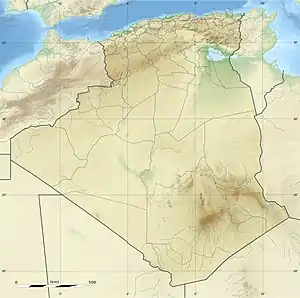 Location of Djorf Torba Dam in Algeria | |
| Official name | Barrage Djorf-Torba |
| Country | Algeria |
| Location | Kenadsa District, Béchar Province |
| Coordinates | 31°30′38″N 2°46′16″W / 31.51056°N 2.77111°W |
| Purpose | Water supply |
| Status | Operational |
| Opening date | 1968 |
| Dam and spillways | |
| Impounds | Oued Guir |
| Height | 38 m (125 ft) |
| Dam volume | 1,900,000 m3 (2,485,106 cu yd) (as of 2006)[1] |
| Reservoir | |
| Total capacity | 350,000,000 m3 (457,782,717 cu yd)[2] |
| Active capacity | 190,000,000 m3 (248,510,618 cu yd) (as of 2006)[1] |
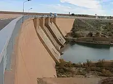
Djorf Torba Dam is a dam in Kenadsa District, Béchar Province, Algeria, crossing the Oued Guir about 50 kilometres (31 mi) west of the capital, Béchar.[3][4] It is used for the purposes of irrigation and water supply.[2] The area around the head of the dam features a number of notable ancient monuments.[5] The dam has resulted in a significant reduction in the flow of Oued Guir and Oued Saoura in locations downstream of the dam.[1]
References
- 1 2 3 Merzougui, Touhami. "L'eau dans l'oasis de Béni Abbés : un patrimoine essentiel (Vallée de la Saoura, Sud Ouest algérien)" (PDF). Nature Vivante. Retrieved 21 February 2013.
- 1 2 "African Dam Factsheet". UN FAO. Retrieved 21 February 2013.
- ↑ Lahlou, Abdelhadi (1996). "Environmental and socio-economic impacts of erosion and sedimentation in north Africa" (PDF). Erosion and Sediment Yield: Global and Regional Perspectives. International Association of Hydrological Sciences. Archived from the original (PDF) on 20 March 2013. Retrieved 22 February 2013.
- ↑ "Google Maps". Google. Retrieved 22 February 2013.
- ↑ G. Camps (1995). "Djorf Torba". Encyclopédia Berbère (in French) (16): 2477–2488. doi:10.4000/encyclopedieberbere.2197. Retrieved 22 February 2013.
This article is issued from Wikipedia. The text is licensed under Creative Commons - Attribution - Sharealike. Additional terms may apply for the media files.