Dewittville | |
|---|---|
Unincorporated community | |
 | |
 Dewittville | |
| Coordinates: 45°06′50″N 74°05′42″W / 45.114°N 74.095°W | |
| Country | Canada |
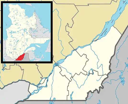
| Province | Quebec |
| Region | Montérégie |
| RCM | Le Haut-Saint-Laurent |
| Municipality | Godmanchester |
| Named for | Jacob De Witt |
| Time zone | UTC-5 (EST) |
| • Summer (DST) | UTC-4 (EDT) |
| Postal code | J0S 1C0 |
| Area code(s) | 450, 579, and 354 |
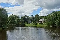
Dewittville is a small community situated on the Chateauguay River in southern Quebec, Canada, between the towns of Huntingdon and Ormstown, approximately 70 km south-west of Montreal.[1]
In 1829, Jacob De Witt acquired a sawmill and 130 acres (53 ha) of land at Portage, which was later renamed to Dewittville.[2] The old grist mill, dam, and Chateauguay River are notable attractions.[3]
References
- ↑ Raza, Moonis (1990). Geographical Dictionary Of The World In The Early 20th Century With Pronouncing Gazetteer (in 2 Vos.). Concept Publishing Company. ISBN 978-81-7268-011-4.
- ↑ "Godmanchester". www.mrchsl.com. MRC du Haut-Saint-Laurent. 1 February 2017. Retrieved 27 September 2023.
- ↑ Bartholomew, John George; Harper, John Murdoch (1890). The Pocket Atlas and Gazetteer of the Dominion of Canada. J. Walker.
This article is issued from Wikipedia. The text is licensed under Creative Commons - Attribution - Sharealike. Additional terms may apply for the media files.