| Dagang 大港区 | |||||||||
|---|---|---|---|---|---|---|---|---|---|
| District of the People's Republic of China | |||||||||
| 1979–2009 | |||||||||
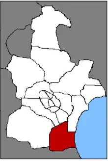 Location of Dagang in Tianjin | |||||||||
| History | |||||||||
• Established | 1979 | ||||||||
• Disestablished | 2009 | ||||||||
| |||||||||
| Today part of | Part of the Binhai New Area, Tianjin | ||||||||
Dagang District (Chinese: 大港区; pinyin: Dàgǎng Qū; lit. 'Great Port District') was a former district of Tianjin, located at the city's southeast. It had a population of 440,000 and occupied 1,113.83 km2 (430.05 sq mi) in size, with a coast line stretching approximately 25 km (16 mi) on the eastern side.[1]
Established in 1979, Dagang has developed a foundation of petroleum chemistry and hosts Dagang Oilfield within its border. In November 2009 Binhai New Area was consolidated into a district, and the former subordinate districts of Tanggu, Hangu and Dagang were abolished.
Climate
| Climate data for Dagang District (1991–2020 normals, extremes 1981–2010) | |||||||||||||
|---|---|---|---|---|---|---|---|---|---|---|---|---|---|
| Month | Jan | Feb | Mar | Apr | May | Jun | Jul | Aug | Sep | Oct | Nov | Dec | Year |
| Record high °C (°F) | 13.2 (55.8) |
19.9 (67.8) |
28.5 (83.3) |
32.9 (91.2) |
37.6 (99.7) |
40.3 (104.5) |
41.2 (106.2) |
36.5 (97.7) |
35.6 (96.1) |
30.8 (87.4) |
21.4 (70.5) |
14.9 (58.8) |
41.2 (106.2) |
| Mean daily maximum °C (°F) | 1.9 (35.4) |
5.4 (41.7) |
12.2 (54.0) |
20.1 (68.2) |
26.1 (79.0) |
29.4 (84.9) |
31.0 (87.8) |
30.2 (86.4) |
26.5 (79.7) |
19.6 (67.3) |
10.7 (51.3) |
3.7 (38.7) |
18.1 (64.5) |
| Daily mean °C (°F) | −2.7 (27.1) |
0.5 (32.9) |
6.9 (44.4) |
14.4 (57.9) |
20.6 (69.1) |
24.8 (76.6) |
27.2 (81.0) |
26.5 (79.7) |
21.9 (71.4) |
14.6 (58.3) |
6.1 (43.0) |
−0.6 (30.9) |
13.4 (56.0) |
| Mean daily minimum °C (°F) | −6.3 (20.7) |
−3.4 (25.9) |
2.6 (36.7) |
9.6 (49.3) |
15.7 (60.3) |
20.6 (69.1) |
23.8 (74.8) |
23.0 (73.4) |
17.7 (63.9) |
10.3 (50.5) |
2.2 (36.0) |
−4.1 (24.6) |
9.3 (48.8) |
| Record low °C (°F) | −19.4 (−2.9) |
−18.4 (−1.1) |
−8.5 (16.7) |
−0.7 (30.7) |
6.8 (44.2) |
10.7 (51.3) |
17.3 (63.1) |
14.8 (58.6) |
6.4 (43.5) |
−4.4 (24.1) |
−10.9 (12.4) |
−19.3 (−2.7) |
−19.4 (−2.9) |
| Average precipitation mm (inches) | 2.4 (0.09) |
5.9 (0.23) |
6.6 (0.26) |
21.3 (0.84) |
39.1 (1.54) |
69.5 (2.74) |
171.0 (6.73) |
125.5 (4.94) |
48.2 (1.90) |
32.0 (1.26) |
14.0 (0.55) |
2.8 (0.11) |
538.3 (21.19) |
| Average precipitation days (≥ 0.1 mm) | 1.7 | 2.3 | 2.5 | 4.6 | 6.1 | 8.3 | 11.1 | 9.4 | 6.3 | 5.0 | 3.3 | 1.8 | 62.4 |
| Average snowy days | 2.7 | 2.6 | 0.9 | 0.1 | 0 | 0 | 0 | 0 | 0 | 0 | 1.1 | 2.7 | 10.1 |
| Average relative humidity (%) | 56 | 55 | 51 | 52 | 55 | 65 | 74 | 75 | 68 | 62 | 61 | 57 | 61 |
| Mean monthly sunshine hours | 178.8 | 181.6 | 231.8 | 243.5 | 271.4 | 233.8 | 203.3 | 209.3 | 211.5 | 200.2 | 166.7 | 165.7 | 2,497.6 |
| Percent possible sunshine | 59 | 59 | 62 | 61 | 61 | 53 | 45 | 50 | 57 | 59 | 56 | 57 | 57 |
| Source: China Meteorological Administration[2][3] | |||||||||||||
References
- ↑ "Dagang District". Archived from the original on 11 December 2006. Retrieved 31 August 2013.
- ↑ 中国气象数据网 – WeatherBk Data (in Simplified Chinese). China Meteorological Administration. Retrieved 26 August 2023.
- ↑ 中国气象数据网 (in Simplified Chinese). China Meteorological Administration. Retrieved 26 August 2023.
External links
- Official site (Chinese and English)
| Districts |  | |
|---|---|---|
| Defunct Districts | ||
This article is issued from Wikipedia. The text is licensed under Creative Commons - Attribution - Sharealike. Additional terms may apply for the media files.